
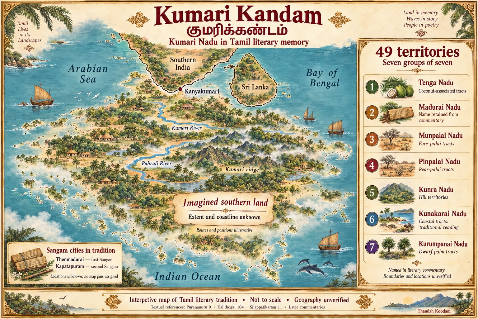
Kumari Kandam is the name widely used today for a lost southern land associated with the ancient Tamils. Its story brings together accounts of land taken by the sea, Pandyan kings, literary academies, vanished settlements and the survival of Tamil learning.
The tradition developed over time. Early Tamil poems mention a river called Pahruli and describe the sea taking a southern ruler’s land. Later commentaries offer a more elaborate account, including two rivers, mountain regions, forty-nine territories and cities associated with the Tamil Sangams. Modern writers connected these traditions with the nineteenth-century hypothesis of Lemuria.
These sources make Kumari Kandam a rich subject for studying literature, historical imagination and cultural memory. Its identification as a vast submerged Tamil continent, however, has not been established by archaeological or geological evidence. Appreciating the tradition involves understanding both what its sources preserve and what remains uncertain.
Source: critical overview by S. C. Jayakaran.
தமிழில் அறிமுகம்
குமரிக்கண்டம் என்பது தமிழர் மரபில் கடலால் கொள்ளப்பட்டதாகக் கூறப்படும் தென்பகுதி நிலத்துடன் தொடர்புடைய பெயராகும். பஃறுளி ஆறு, குமரிக் கோடு, பாண்டியர் நிலம் கடலால் கொள்ளப்பட்ட செய்திகள் ஆகியவை தமிழ் இலக்கியங்களில் இடம்பெறுகின்றன. பிற்கால உரைகளில் நாற்பத்தொன்பது நாடுகள், குமரி ஆறு, மலைநாடுகள் மற்றும் சங்க நகரங்கள் பற்றிய விரிவான விளக்கங்கள் காணப்படுகின்றன.
இச்செய்திகள் அனைத்தும் ஒரே காலத்தைச் சேர்ந்தவை அல்ல. பாடல்களில் உள்ள குறிப்புகள், உரையாசிரியர்களின் விளக்கங்கள், பிற்கால எழுத்தாளர்களின் கருத்துகள் ஆகியவற்றை அவற்றின் தனித்தனி சூழலில் புரிந்துகொள்ள வேண்டும்.
கடல்மட்ட மாற்றங்களும் கரையோர நில இழப்புகளும் உண்மையான இயற்கை நிகழ்வுகள். இருப்பினும், அவை மட்டும் குமரிக்கண்டம் என்ற பெயருடைய ஒரு பெருங்கண்டத்தையோ அதன் நகரங்களையோ உறுதிப்படுத்துவதில்லை.
குமரிக்கண்டத்தைப் பற்றிய ஆய்வு, தமிழ் இலக்கியம், நிலவியல், தொல்லியல் மற்றும் பண்பாட்டு நினைவு ஆகியவற்றை இணைத்துப் பார்க்க உதவுகிறது. இப்பக்கத்தின் வரைபடம் அந்த மரபை விளக்கும் கற்பனைப்படமாகும்; அதன் துல்லியமான புவியியல் அமைப்பு இன்னும் உறுதிப்படுத்தப்படவில்லை.
Understanding the names: Kumari Nadu and Kumari Kandam
The names Kumari Nadu and Kumari Kandam are often used interchangeably, although their meanings and historical uses deserve attention.
Kumari Nadu — குமரி நாடு means the land or territory of Kumari. The word nādu can describe a region or country, but it does not automatically indicate a continent, a modern nation-state or a territory of a particular size.
Kumari Kandam — குமரிக்கண்டம் is now commonly associated with the idea of a large lost landmass south of India. Historian Sumathi Ramaswamy distinguishes the term’s earlier cosmological use from its later identification with an ancestral Tamil homeland. The modern meaning should therefore not be read automatically into every older occurrence of the name.
In Tamil sources, Kumari can also refer to different geographical or sacred features. The accompanying words matter: குமரி ஆறு identifies a river, while குமரிக் கோடு refers to a ridge or mountain feature in the relevant Silappatikaram passage.
தமிழில்
குமரி நாடு, குமரிக்கண்டம் ஆகிய இரு பெயர்களும் இன்று ஒன்றுக்கொன்று மாற்றாகப் பயன்படுத்தப்படுகின்றன; ஆனால் அவற்றின் பொருளும் வரலாற்றுப் பயன்பாடும் வேறுபடுகின்றன. ‘நாடு’ என்பது ஒரு நிலப்பகுதியையோ வட்டாரத்தையோ குறிக்கும்; அது ஒரு கண்டத்தையோ குறிப்பிட்ட அளவுடைய நாட்டையோ தானாகக் குறிப்பதில்லை. ‘குமரிக்கண்டம்’ என்ற சொல் முற்காலத்தில் அண்டவியல் பொருளில் வழங்கியது என்றும், தமிழரின் தொன்மைத் தாயகம் என்ற பொருள் பிற்காலத்தில் இணைந்தது என்றும் வரலாற்றாசிரியர் சுமதி ராமசாமி விளக்குகிறார். ‘குமரி ஆறு’ ஓர் ஆற்றையும், ‘குமரிக் கோடு’ ஒரு மலைமுகட்டையும் குறிக்கின்றன.
Source: Sumathi Ramaswamy, “History at Land’s End”.
The earliest literary clues
The literary foundation of the lost-land tradition consists of several passages with different purposes and contexts. Reading them individually helps us understand how the larger story developed.
Pahruli in Purananuru
Poem 9 of Purananuru invokes the river Pahruli while praising the Pandyan ruler Mudukudumi Peruvazhuthi. Its closing passage includes:
நன்னீர்ப் பஃறுளி மணலினும் பலவே.The poet wishes the ruler a life exceeding the grains of sand of the good-watered Pahruli.
This passage establishes that Pahruli was a name within the poem’s geographical and royal world. It does not itself describe the river being submerged or identify a continent. Its connection with sea engulfment emerges from other texts and their interpretation.
தமிழில்
புறநானூற்றின் ஒன்பதாம் பாடல், பாண்டியன் முதுகுடுமிப் பெருவழுதியை வாழ்த்தும்போது பஃறுளி ஆற்றைக் குறிப்பிடுகிறது: நன்னீர்ப் பஃறுளி ஆற்று மணலினும் பல ஆண்டுகள் வாழ்க என்பது அதன் பொருள். பஃறுளி என்ற பெயர் அப்பாடலின் நிலவியல், அரசியல் உலகில் வழங்கியதை இது காட்டுகிறது. ஆறு கடலில் மூழ்கியதாகவோ ஒரு கண்டம் இருந்ததாகவோ இப்பாடல் கூறவில்லை; கடல்கோளோடு உள்ள தொடர்பு பிற நூல்களிலிருந்தும் அவற்றின் விளக்கங்களிலிருந்தும் உருவாகிறது.
Source: Purananuru, poem 9 (Project Madurai Tamil text).
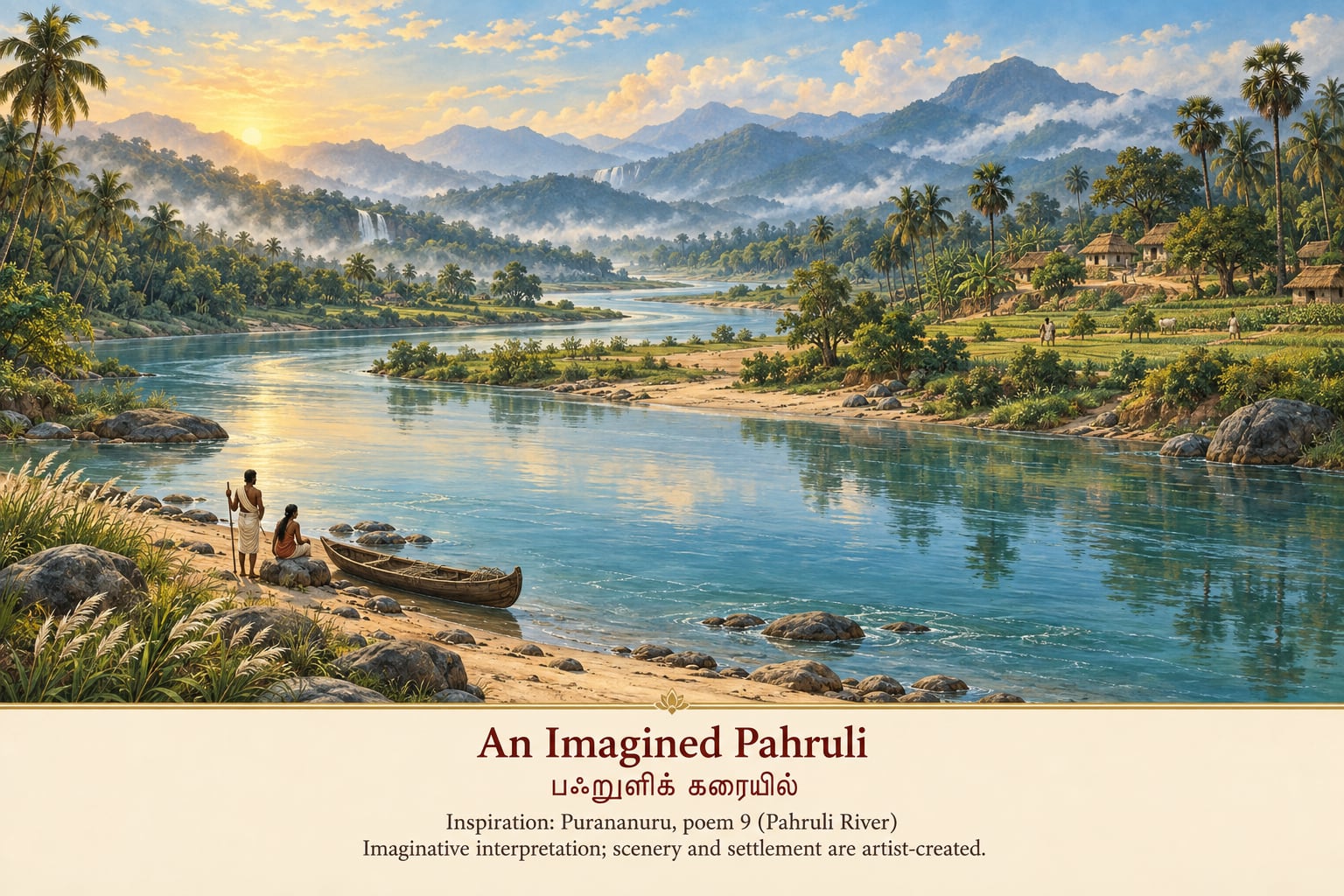
An Imagined Pahruli பஃறுளிக் கரையில்
A luminous river valley imagines the landscape around the Pahruli named in Purananuru. The poem invokes the river’s sands in royal praise. Its mention does not establish the particular mountains, farms, boats or houses pictured here; poem 9 itself does not describe the river sinking.
புறநானூற்றின் ஒன்பதாம் பாடலில் குறிப்பிடப்படும் பஃறுளி ஆற்றை நினைவூட்டும் காட்சி. ஆற்றின் மணலைக் கொண்டு அரசனின் வாழ்நாளை வாழ்த்தும் பாடல் அது. இங்கு காட்டப்படும் மலைகளும் குடியிருப்புகளும் படகும் கற்பனையில் அமைந்தவை.
Literary inspiration: Purananuru, poem 9 — Project Madurai Tamil text
Land taken by the sea in Kalithogai
Poem 104 of Kalithogai begins with the sea advancing over a ruler’s land:
மலி திரை ஊர்ந்து தன் மண் கடல் வௌவலின்…The passage praises the southern king for responding through expansion into rival territories. Its imagery contrasts the Pandyan fish emblem with the tiger and bow associated with rival rulers.
Here, the loss of land to the sea is explicit. The poem does not supply a date, a measured area or a scientific explanation for the event. Its immediate purpose is to celebrate royal strength in the face of loss.
தமிழில்
கலித்தொகையின் 104-ஆம் பாடல், அலைகள் பெருகி வந்து அரசனின் மண்ணைக் கடல் கவர்ந்ததைத் தொடக்கத்திலேயே கூறுகிறது. நிலத்தை இழந்த தென்னவன், பகைவர் நிலங்களை வென்று அதனை ஈடுசெய்ததை அது புகழ்கிறது; பாண்டியரின் மீன் கொடி, பகை வேந்தரின் புலி, வில் சின்னங்களோடு ஒப்பிடப்படுகிறது. நில இழப்பு இங்கே வெளிப்படையாகக் கூறப்படுகிறது; ஆனால் காலம், பரப்பளவு, காரணம் ஆகியவை கூறப்படவில்லை.
Source: Kalithogai, poem 104.
Pahruli and the Kumari ridge in Silappatikaram
One of the most frequently cited passages appears in the Kaadukaan Kaathai of Silappatikaram:
பஃறுளி யாற்றுடன் பன்மலை யடுக்கத்துக்
குமரிக் கோடுங் கொடுங்கடல் கொள்ள
வடதிசைக் கங்கையும் இமயமுங் கொண்டு
தென்றிசை யாண்ட தென்னவன் வாழி.In a close paraphrase, the passage praises the southern king who, after the sea took Pahruli and the Kumari ridge amid mountain ranges, acquired the northern Ganges and Himalaya and ruled the south.
This is a significant literary connection between named landscape features and destruction by the sea. It appears within praise of Pandyan kings, rather than a geographical survey. The passage preserves the tradition’s imagery but cannot independently establish a coastline, city location or disaster chronology.
தமிழில்
சிலப்பதிகாரத்தின் காடுகாண் காதை, பஃறுளி ஆற்றையும் பல மலை அடுக்குகளோடு கூடிய குமரிக் கோட்டையும் கொடுங்கடல் கொண்டதாகக் கூறி, பின்னர் வடதிசையில் கங்கையையும் இமயத்தையும் கொண்டு தென்திசையை ஆண்ட தென்னவனை வாழ்த்துகிறது. பெயர் சுட்டப்பட்ட நிலப்பகுதிகளையும் கடல்கோளையும் இணைக்கும் முக்கியமான இலக்கியச் சான்று இது. ஆயினும் இது பாண்டியரைப் புகழும் பகுதி; நில அளவை அறிக்கை அல்ல. கடற்கரை, நகர இருப்பிடம், நிகழ்வின் காலம் ஆகியவற்றை இதைக் கொண்டு மட்டும் உறுதிசெய்ய இயலாது.
Source: Silappatikaram, canto 11, lines 19–22 (Project Madurai Tamil text).
The landscape described in later commentary
A more extensive account appears in the commentary of Adiyarkunallar on Silappatikaram. This later explanation describes a territory associated with the Pahruli and Kumari rivers, forty-nine nādu, mountain regions, forests, rivers and inhabited places.
The distinction between poem and commentary matters. The epic provides a brief, powerful reference to engulfment. The commentator supplies much of the geographical detail now associated with Kumari Nadu.
The passage survives in reproduced form in works such as V. K. Suryanarayana Sastriyar’s Tamil Mozhiyin Varalaru. It presents a landscape of considerable variety, but its names cannot yet be matched securely to a complete physical map.
Several features are central to this literary geography:
| Feature | Place in the tradition |
|---|---|
| Pahruli — பஃறுளி | A river mentioned in poetry and associated with the lost landscape. |
| Kumari River — குமரி ஆறு | A river used in the commentary’s description of the territory. |
| Kumari ridge — குமரிக் கோடு | A mountain feature named in the epic’s account of sea engulfment. |
| Kumari and Kollam | Names associated with mountain tracts in the commentary. |
| Tenpali-mukam — தென்பாலி முகம் | A territorial expression used in describing boundary relationships. |
| Thenmadurai and Kapatapuram | Cities associated with the first two Sangams in the literary tradition. |
These names provide material for studying how the land was described and remembered. Their modern coordinates, river courses and boundaries remain unresolved.
தமிழில்
சிலப்பதிகாரத்திற்கு அடியார்க்குநல்லார் எழுதிய உரையில் விரிவான விளக்கம் காணப்படுகிறது: பஃறுளி, குமரி என்னும் இரு ஆறுகளோடு தொடர்புடைய நிலம், நாற்பத்தொன்பது நாடுகள், மலைகள், காடுகள், ஆறுகள், ஊர்கள். காப்பியம் கடல்கோளைச் சுருக்கமாகவே குறிப்பிடுகிறது; இன்று குமரி நாட்டோடு இணைத்துப் பேசப்படும் புவியியல் விவரங்களில் பெரும்பகுதி உரையாசிரியர் தந்தவை. இப்பெயர்களை இன்றைய நிலவரைபடத்தில் உறுதியாகப் பொருத்த இன்னும் இயலவில்லை.
Source: Tamil Mozhiyin Varalaru, discussion of Tamil antiquity.
The forty-nine territories
The familiar account of forty-nine territories consists of seven groups of seven.
The commentary gives seven collective names. It does not provide forty-nine individually named cities or forty-nine boundaries that can be transferred directly onto a modern map.
| Tamil name | Common rendering | Cautious explanation |
|---|---|---|
| ஏழ் தெங்க நாடு | Seven Tenga territories | Coconut-associated tracts. |
| ஏழ் மதுரை நாடு | Seven Madurai territories | The name Madurai is retained; a specific agricultural meaning is not established by the passage. |
| ஏழ் முன்பாலை நாடு | Seven Munpalai territories | Fore or front pālai tracts. |
| ஏழ் பின்பாலை நாடு | Seven Pinpalai territories | Rear or back pālai tracts. |
| ஏழ் குன்ற நாடு | Seven Kunra territories | Hill territories. |
| ஏழ் குணகாரை நாடு | Seven Kunakarai territories | Often interpreted as eastern coastal tracts; readings and spellings vary. |
| ஏழ் குறும்பனை நாடு | Seven Kurumpanai territories | Dwarf-palm-associated tracts. |
The names evoke different kinds of terrain and vegetation. They should nevertheless be treated as terms in a literary geographical account, rather than a verified ecological classification.
These seven groups are also distinct from the five tiṇai of Tamil poetry. The two systems should not be combined as though they describe the same geographical divisions.
தமிழில்
நாற்பத்தொன்பது நாடுகள் என்பது ஏழு ஏழாக அமைந்த ஏழு தொகுதிகள்: ஏழ் தெங்க நாடு, ஏழ் மதுரை நாடு, ஏழ் முன்பாலை நாடு, ஏழ் பின்பாலை நாடு, ஏழ் குன்ற நாடு, ஏழ் குணகாரை நாடு, ஏழ் குறும்பனை நாடு. உரை இந்த ஏழு தொகுதிப் பெயர்களை மட்டுமே தருகிறது; நாற்பத்தொன்பது தனித்தனிப் பெயர்களையோ எல்லைகளையோ தரவில்லை. இப்பெயர்கள் நிலத்தின் தன்மையையும் தாவரங்களையும் நினைவூட்டுகின்றன; ஆயினும் அவை இலக்கிய நிலவியல் சொற்களே. இவை ஐந்திணைப் பகுப்பிலிருந்து வேறானவை.
Source: commentary passage reproduced in Tamil Mozhiyin Varalaru.
How large was Kumari Nadu?
The commentary refers to an extent of seven hundred kāvatam between the Pahruli and Kumari rivers. This has encouraged many attempts to calculate the land’s size.
A dependable conversion requires more than choosing a modern equivalent for an old unit. It would require an established reading of the passage, a historically appropriate value for kāvatam, and identified endpoints.
The statement also describes an extent, rather than an area. Even a securely known distance between two rivers would not reveal the land’s width, coastline or total surface area.
Consequently, precise figures for Kumari Nadu’s size — and maps assigning it fixed continental boundaries — should be understood as reconstructions unless supported by additional evidence.
தமிழில்
பஃறுளி ஆற்றுக்கும் குமரி ஆற்றுக்கும் இடையே எழுநூறு காவதம் என்று உரை கூறுகிறது. காவதத்தின் அக்கால அளவும் இரு ஆறுகளின் இருப்பிடமும் உறுதியாகத் தெரியாததால், இதை இன்றைய அளவுகளுக்கு நம்பகமாக மாற்ற இயலாது. மேலும் இது ஒரு நீளத்தைக் குறிக்கிறது; பரப்பளவை அல்ல. எனவே குமரி நாட்டின் அளவு குறித்த துல்லியமான எண்களும், அதற்குக் கண்ட எல்லைகளை வரையும் வரைபடங்களும் மீட்டுருவாக்க முயற்சிகளே.
The Sangams and their cities
The lost-land tradition is closely connected with the account of three Tamil Sangams, or literary academies.
The prefatory commentary to Iraiyanar Akapporul, traditionally attributed to Nakkirar, describes successive assemblies supported by Pandyan rulers. It names their participants, associated works and locations.
| Sangam | Location in the account | Role in the tradition |
|---|---|---|
| First Sangam — தலைச்சங்கம் | A Madurai taken by the sea, conventionally distinguished as Thenmadurai | An early centre of Tamil learning. |
| Second Sangam — இடைச்சங்கம் | Kapatapuram | A subsequent academy associated with another phase of Pandyan land loss. |
| Third Sangam — கடைச்சங்கம் | Uttara Madurai | The academy connected in the account with familiar classical anthologies. |
The narrative includes poets and rulers alongside sacred figures such as Shiva, Murugan and Agastya. Its academies are assigned very long durations.
These details give the account a sacred and literary character. They should not be treated as an independently verified institutional calendar. The surviving Sangam poems are historical objects of study; the full story of three academies requires its own assessment.
தமிழில்
நக்கீரர் பெயரால் வழங்கும் இறையனார் அகப்பொருள் உரை, பாண்டியர் புரந்த மூன்று சங்கங்களைக் கூறுகிறது: கடல்கொண்ட மதுரையில் (தென்மதுரை) தலைச்சங்கம், கபாடபுரத்தில் இடைச்சங்கம், உத்தர மதுரையில் கடைச்சங்கம். சிவபெருமான், முருகன், அகத்தியர் ஆகியோரும் புலவர்களோடு இடம்பெறுகின்றனர்; சங்கங்களுக்கு மிக நீண்ட காலங்கள் கூறப்படுகின்றன. இவை இக்கதைக்குப் புனிதமும் இலக்கியமும் கலந்த தன்மையைத் தருகின்றன; சான்றுகளால் உறுதிப்படுத்தப்பட்ட வரலாற்றுக் காலக்கணக்காக இதைக் கொள்ளக் கூடாது.
Source: Iraiyanar Akapporul, prefatory commentary extract on the three Sangams (Project Madurai).
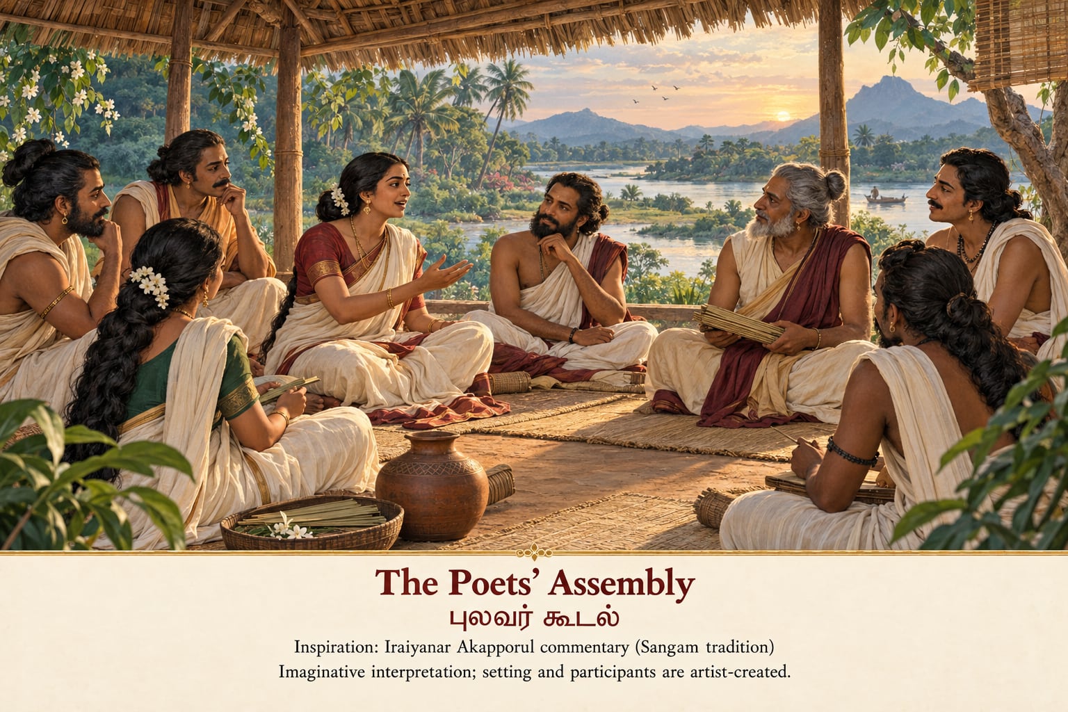
The Poets’ Assembly புலவர் கூடல்
A scene of conversation and poetic learning takes its theme from the Sangam academy tradition in the prefatory commentary to Iraiyanar Akapporul. The commentary places an early assembly in a Madurai said to have been taken by the sea. The pavilion, gathering and individuals here are imaginative choices, not identifiable historical portraits.
இறையனார் அகப்பொருள் உரையில் கூறப்படும் சங்க மரபை நினைவூட்டும் புலவர் கூடல். உரையில் கடல்கொண்ட மதுரையில் தமிழாய்ந்த சங்கம் பற்றிய குறிப்பு உள்ளது. இங்குள்ள மனிதர்களும் மண்டபமும் கலைக் கற்பனையில் உருவாக்கப்பட்டவை.
Literary inspiration: Iraiyanar Akapporul — prefatory commentary extract on the three Sangams, Project Madurai
Thenmadurai and Kapatapuram
Thenmadurai and Kapatapuram are important because they give the tradition places around which to organize the transmission of Tamil learning.
Their names are preserved in literary accounts, but those accounts do not provide securely identified ruins, city plans or modern coordinates. An illustrated map can introduce the cities through an inset or a list of literary places. A precise pin would suggest a level of geographical certainty that the evidence does not support.
The memory of lost books
The academy account also names works associated with earlier periods of learning, including Akattiyam, Mutunarai, Mutukuruku, Mapuranam and Isainunukkam.
Such references preserve the memory of a larger literary world. A title mentioned in commentary does not, however, reveal the complete contents or date of a lost work. Nor does its absence today demonstrate that a flood caused its disappearance.
The tradition can be read as a reflection on a continuing human concern: how language and knowledge survive when institutions, settlements and texts are lost.
Pandyan kingship and the lost southern land
Pandyan kingship connects several strands of the story. In the poems, the ruler confronts the loss of territory. In the academy narrative, kings sustain Tamil learning across successive centres.
This relationship gives Kumari Nadu a political as well as a literary dimension. Land supports a kingdom; royal patronage supports poets; the loss of a city threatens the institutions through which knowledge is preserved.
The texts do not supply enough independently verifiable information to reconstruct a complete sequence of rulers, territorial borders or migrations across an enormous southern continent. They do show how the tradition brings political continuity and the continuity of Tamil learning into the same narrative.
தமிழில்
தென்மதுரை, கபாடபுரம் ஆகிய பெயர்கள் இலக்கியத்தில் உள்ளன; ஆனால் அவற்றின் இடிபாடுகளோ இருப்பிடமோ இதுவரை அடையாளம் காணப்படவில்லை. அகத்தியம், முதுநாரை, முதுகுருகு, மாபுராணம், இசைநுணுக்கம் போன்ற நூல்களின் பெயர்களும் இம்மரபில் இடம்பெறுகின்றன; பெயர் மட்டும் அந்நூல்களின் உள்ளடக்கத்தையோ காலத்தையோ, அவை கடல்கோளால் அழிந்தன என்பதையோ உறுதிசெய்யாது. நிலம் அரசைத் தாங்குகிறது; அரசு புலவரைப் புரக்கிறது; நகரம் அழிந்தாலும் தமிழ்க் கல்வி தொடர்கிறது — இதுவே இம்மரபு இணைத்துக் காட்டும் கருத்து.
Source: Kalithogai 104; Iraiyanar Akapporul commentary.
How Lemuria became connected with Kumari Kandam
In 1864, zoologist Philip Lutley Sclater proposed Lemuria in a paper about the mammals of Madagascar. It was an attempt to explain animal distribution through a former land connection. The proposal arose before modern plate tectonics.
Some later Tamil writers connected this hypothesis with literary accounts of southern land loss. Ramaswamy traces the process through scholarship, public lectures and maps, including Suryanarayana Sastri’s use of Kumari Nadu in 1903.
This connection helped transform scattered textual references into expansive modern representations of a lost homeland. It is an important part of the history of the idea, but it does not establish that the European hypothesis and the Tamil literary landscape described the same physical landmass.
தமிழில்
1864-இல் விலங்கியலாளர் பிலிப் ஸ்க்லேட்டர், மடகாஸ்கரின் பாலூட்டிகளின் பரவலை விளக்க ‘லெமூரியா’ என்ற பழைய நிலத்தொடர்பை முன்மொழிந்தார். இது கண்டத்தட்டு இயக்கவியல் அறியப்படுவதற்கு முந்தைய கருதுகோள். பின்னர் சில தமிழ் அறிஞர்கள் இக்கருதுகோளைக் கடல்கோள் பற்றிய இலக்கியக் குறிப்புகளோடு இணைத்தனர்; 1903-இல் சூரியநாராயண சாஸ்திரியார் ‘குமரி நாடு’ என்ற பெயரைப் பயன்படுத்தினார். இந்த இணைப்பு இக்கருத்தின் வரலாற்றில் முக்கியமானது; ஆனால் ஐரோப்பியக் கருதுகோளும் தமிழ் இலக்கிய நிலமும் ஒரே நிலப்பரப்பைக் குறித்தன என்பதை அது நிறுவவில்லை.
Source: Darwin Online’s record of Sclater’s paper; Ramaswamy’s historical study.
What geology can tell us
Geology gives us strong reasons to investigate former coastlines. It also helps distinguish different meanings of “lost land.”
Sea-level rise and submerged coastlines
Global sea level was approximately 120 metres lower around 20,000 years ago. As large ice sheets melted, rising seas covered previously exposed ground.
This provides a real mechanism for submerged coastal landscapes. It does not, by itself, identify the inhabitants’ language, the name of their country or the location of a literary city.
Source: NASA GISS sea-level overview.
Local coastal change
A coastline can change through erosion, sediment accumulation, river-mouth movement and destructive wave events. Research on shore deposits and corals along southern India demonstrates the value of studying local evidence.
Connecting a particular literary account with a particular event requires compatible locations, dates and physical findings. A general history of changing seas cannot supply that connection on its own.
Source: regional sea-level study in Marine Geology.
Ancient continental fragments
Research beneath Mauritius has identified evidence of ancient continental crust. The 2017 study concerns zircons and geological history on vastly older timescales than human civilization.
These findings are important for understanding the Indian Ocean. They do not identify a Tamil settlement or demonstrate that Kumari Nadu existed on that crust. The age of a rock is not the age of a civilization.
Source: Ashwal and colleagues, Nature Communications.
தமிழில்
ஏறத்தாழ 20,000 ஆண்டுகளுக்கு முன் கடல்மட்டம் இன்றைவிடச் சுமார் 120 மீட்டர் தாழ்வாக இருந்தது; பனிப்படலங்கள் உருகியபோது கடல் உயர்ந்து கரையோர நிலங்கள் மூழ்கின. கரையரிப்பு, வண்டல் படிவு, ஆற்றுமுக மாற்றம், பேரலைகள் ஆகியவையும் கடற்கரையை மாற்றுகின்றன. மொரீசியஸ் தீவுக்கு அடியில் மிகப் பழைய கண்டத்தோட்டின் தடயங்கள் கண்டறியப்பட்டுள்ளன; ஆனால் அவை மனித நாகரிகத்தைவிட மிகமிகப் பழைய காலத்தவை. இவை எதுவும் தனியாக ஒரு தமிழ் நகரத்தையோ குமரி நாட்டையோ அடையாளம் காட்டுவதில்லை. ஒரு பாறையின் வயது ஒரு நாகரிகத்தின் வயது அல்ல.
What archaeology has found
Tamil Nadu’s coast contains archaeological evidence worth studying independently of the lost-continent question.
At Poompuhar, the state archaeology department reports underwater stone masonry off Vanagiri and assigns the relevant structures approximately to the second century BCE–fourth century CE. These findings contribute to the history of a coastal settlement; they do not establish a continent.
Source: Tamil Nadu Department of Archaeology.
A separate geoarchaeological study at Kaveripattinam identified a sedimentary layer interpreted as evidence of a tsunami around a thousand years ago. Its argument uses physical deposits and dating, illustrating how a coastal-event hypothesis can be investigated. It does not date every literary account of sea engulfment to that event.
Source: Rajendran and colleagues, 2011.
The much older offshore-harbour proposal
A 2020 research paper interpreted seabed anomalies offshore from Poompuhar as harbour-related features and proposed an age of roughly 11,000–15,000 years, based on their relationship to reconstructed shorelines.
That proposal deserves examination, but estimating when a landscape was exposed differs from directly dating human occupation or construction. The identification, age and cultural association of the features require further evidence. They do not establish Thenmadurai, Kapatapuram or Kumari Nadu.
Source: Ramasamy and colleagues, Current Science.
தமிழில்
பூம்புகாரில் வானகிரிக்கு அப்பால் கடலடியில் கற்கட்டுமானங்கள் கண்டறியப்பட்டுள்ளன; தமிழ்நாடு தொல்லியல் துறை அவற்றை ஏறத்தாழ கி.மு. இரண்டாம் நூற்றாண்டு முதல் கி.பி. நான்காம் நூற்றாண்டு வரையிலான காலத்தவை எனக் கணிக்கிறது. காவிரிப்பூம்பட்டினத்தில் நடந்த ஆய்வு, ஏறத்தாழ ஆயிரம் ஆண்டுகளுக்கு முன் ஏற்பட்ட ஆழிப்பேரலையின் படிவை அடையாளம் கண்டது. பூம்புகார்க் கடலில் 11,000–15,000 ஆண்டுகள் பழமையான துறைமுக அமைப்புகள் இருப்பதாக 2020-இல் ஓர் ஆய்வு முன்மொழிந்தது; அதற்கு மேலும் சான்றுகள் தேவை. இக்கண்டுபிடிப்புகள் ஒரு கடற்கரை நகரின் வரலாற்றை அறிய உதவுகின்றன; ஒரு கண்டத்தை நிறுவுவதில்லை.
Reading our Kumari Kandam map
The map on this page is an interpretive illustration of Tamil literary tradition.
Present-day southern India, Kanyakumari and Sri Lanka provide geographical orientation. The southern landscape introduces names and themes from the tradition.
Its rivers, hills, vegetation and settlements are illustrative. The seven groups of territories appear in a legend because their precise distribution is unknown. Thenmadurai and Kapatapuram appear as literary cities without assigned map pins.
The illustration helps readers explore the story while making its uncertainty visible.
தமிழில்
இப்பக்கத்தின் வரைபடம் தமிழ் இலக்கிய மரபை விளக்கும் படம். இன்றைய தென்னிந்தியா, கன்னியாகுமரி, இலங்கை ஆகியவை திசையறிய உதவுகின்றன. ஆறுகள், மலைகள், தாவரங்கள், ஊர்கள் ஆகியவை விளக்கத்திற்காக வரையப்பட்டவை. ஏழு நாட்டுத் தொகுதிகளின் இருப்பிடம் தெரியாததால் அவை குறிப்புப் பட்டியலில் மட்டும் காட்டப்பட்டுள்ளன; தென்மதுரையும் கபாடபுரமும் இடக்குறி இன்றி இலக்கிய நகரங்களாகக் குறிக்கப்பட்டுள்ளன.
About the scenes. The scene pictures on this page are imaginative illustrations inspired by Tamil literary references. The texts inspire the themes; they do not establish the pictured landscapes, buildings, clothing or people. They are AI-generated artworks, not archaeological reconstructions or surviving ancient illustrations.
தமிழ் இலக்கியக் குறிப்புகளால் தூண்டப்பட்ட கற்பனை ஓவியங்கள் இவை. காட்டப்படும் நிலப்பரப்பு, கட்டிடங்கள், உடைகள், மனிதர்கள் ஆகியவை கலைக் கற்பனையில் உருவாக்கப்பட்டவை; தொல்லியல் சான்றுகளின் அடிப்படையில் மீட்டுருவாக்கப்பட்ட காட்சிகள் அல்ல.
What remains unknown
The sources discussed here do not establish:
- The exact coastline, area or southern limit of Kumari Nadu.
- The physical courses of the Pahruli and Kumari rivers.
- Archaeologically identified locations for Thenmadurai and Kapatapuram.
- A single date or cause for all the losses described in the tradition.
- The population, buildings or everyday life of an identified submerged Kumari Nadu society.
- Claims that all humanity, languages or civilizations originated there.
These questions require different kinds of investigation. Textual study can clarify wording and interpretation. Archaeology can examine human activity. Geology can reconstruct environmental change. Strong identifications emerge when independent forms of evidence support the same conclusion.
தமிழில்
இச்சான்றுகள் உறுதிசெய்யாதவை: குமரி நாட்டின் கடற்கரை, பரப்பு, தென் எல்லை; பஃறுளி, குமரி ஆறுகளின் ஓட்டம்; தென்மதுரை, கபாடபுரத்தின் இருப்பிடம்; நில இழப்புகளின் காலமும் காரணமும்; அங்கு வாழ்ந்த மக்களின் வாழ்க்கை; மனித இனமும் மொழிகளும் நாகரிகங்களும் அங்கேயே தோன்றின என்ற கூற்றுகள். இலக்கிய ஆய்வு, தொல்லியல், நிலவியல் ஆகியவை தனித்தனியே ஒரே முடிவை ஆதரிக்கும்போதுதான் உறுதியான அடையாளம் கிடைக்கும்.
Why the tradition matters
Kumari Kandam offers a way to explore the relationship between land, language and belonging. Its stories place rivers, rulers, poets and cities within a landscape threatened by the sea.
One way to read the tradition is as a reflection on continuity: a city may disappear, a kingdom may lose territory, and a work may cease to circulate, while a language continues through those who speak, teach and write it.
The subject also invites close reading. A river mentioned in a poem, a territory described by a commentator and a continent drawn by a modern author each belong to a particular source and context. Understanding those differences makes the history of the tradition more revealing.
At Thamizh Koodam, Kumari Kandam can be explored through its Tamil words, literary places and changing interpretations — with respect for its cultural meaning and care for the evidence.
தமிழில்
குமரிக்கண்டம் பற்றிய மரபு நிலம், மொழி, சொந்தம் ஆகியவற்றுக்கிடையிலான உறவை எண்ணிப் பார்க்க வைக்கிறது. ஒரு நகரம் மறையலாம்; ஓர் அரசு நிலத்தை இழக்கலாம்; ஒரு நூல் வழக்கொழியலாம். ஆயினும் மொழி, அதைப் பேசுவோர், கற்பிப்போர், எழுதுவோர் வழியாகத் தொடர்கிறது. பாடலில் வரும் ஆறு, உரையாசிரியர் விளக்கும் நாடு, பிற்கால எழுத்தாளர் வரைந்த கண்டம் — ஒவ்வொன்றும் தனித்தனிச் சூழலைச் சேர்ந்தது என்பதை உணர்வதே இம்மரபைப் புரிந்துகொள்ளும் வழி.